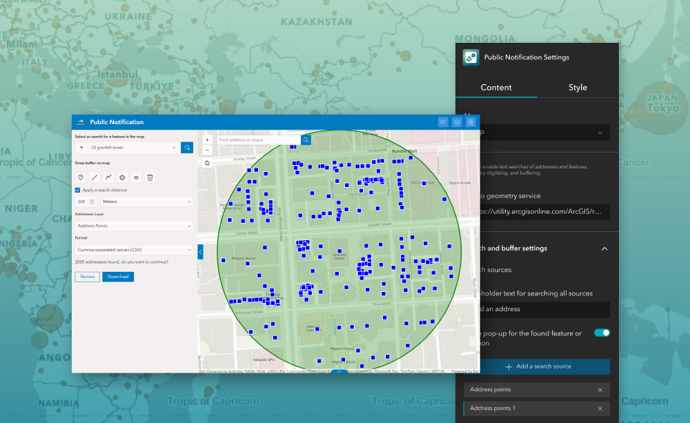
The Public Notification widget lets users identify and compile a list of map features — such as addresses, parcels, or contacts — within a specified area and generate structured outputs for notifying affected stakeholders. Designed for ArcGIS® Experience Builder, this widget supports searching, buffering, drawing, and exporting selected features to formats like CSV or PDF. It empowers planning, zoning, operations, and communications teams to quickly create mailing lists and notification packages directly within their Experience Builder applications.
What it helps you do
- Define an area of interest using search, buffer, or sketch tools.
- Identify all features from configured layers that fall within or intersect that area.
- Generate structured contact or property lists for outreach.
- Export results to CSV or PDF for printing, mailing labels, or further processing.
Key features
- Search & buffer tools — locate an initial point and expand the area with buffer distances to capture nearby features.
- Interactive sketch tools — draw rectangles, polygons, and other shapes to define custom areas of interest.
- Configurable layer inputs — select which layers (e.g., parcels, addresses) will contribute features for notification.
- Export options — output selected feature lists as CSV or formatted PDFs, including mailing labels.
Example use cases
- Generate mailing lists for public notices about road closures, planning applications, or utility works.
- Compile lists of affected properties within a buffer zone around a project site.
- Support outreach for policy changes or community engagement initiatives.
- Produce formatted lists for print or digital reporting (labels, PDFs, spreadsheets).
Using ArcGIS Online?
If you don’t have access to ArcGIS® Experience Builder Developer Edition, try our Hosted Experience Builder environment. It is the fastest way to start using custom widgets like this one. No local setup or deployment required.
Learn more