

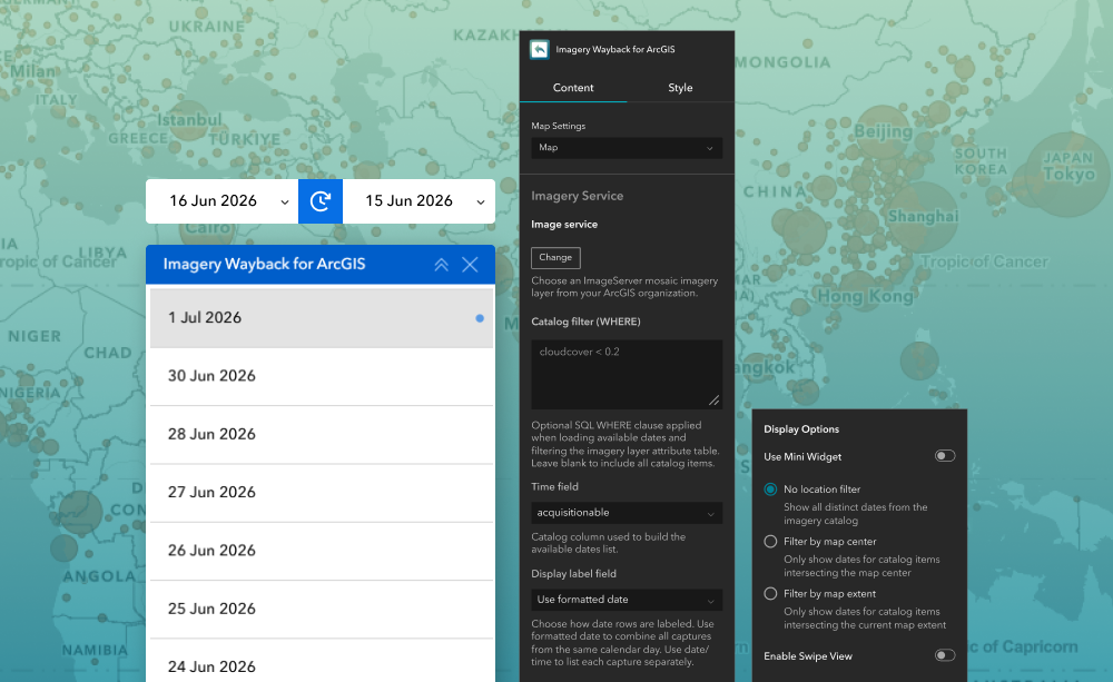
Browse and compare imagery from custom imagery services across different acquisition dates to visualize changes over time.
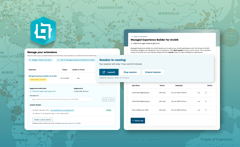
Build and deploy Experience Builder apps without managing infrastructure —just subscribe and start creating.
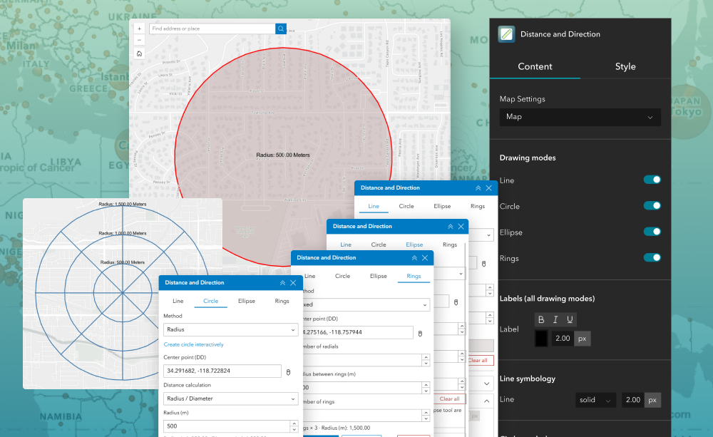
A widget that enables users to create and visualize precise distance, direction, and range measurements directly on the map using lines, circles, ellipses, and rings.
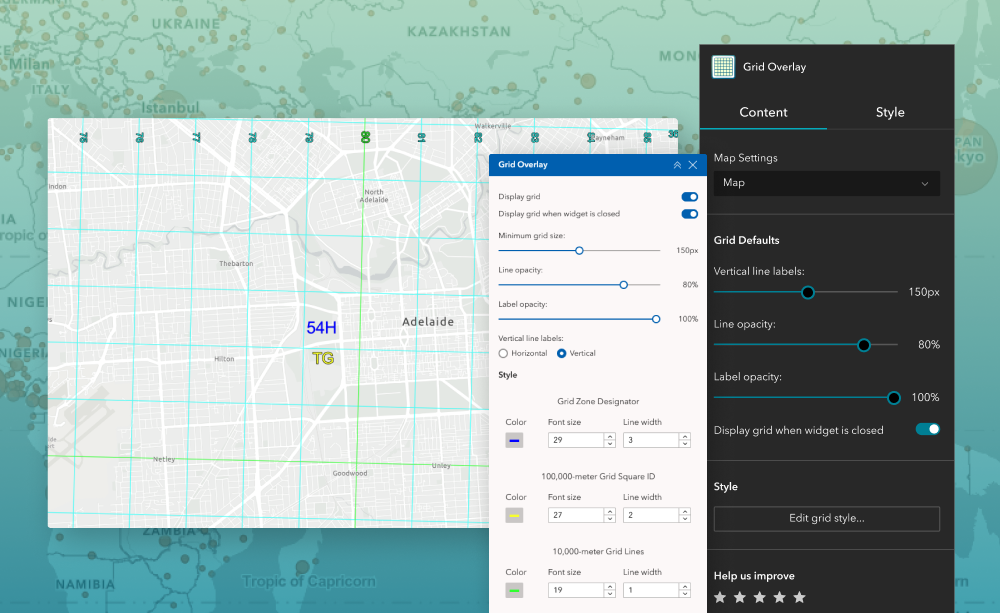
Bring precise military grid reference visibility to your ArcGIS Experience Builder applications.
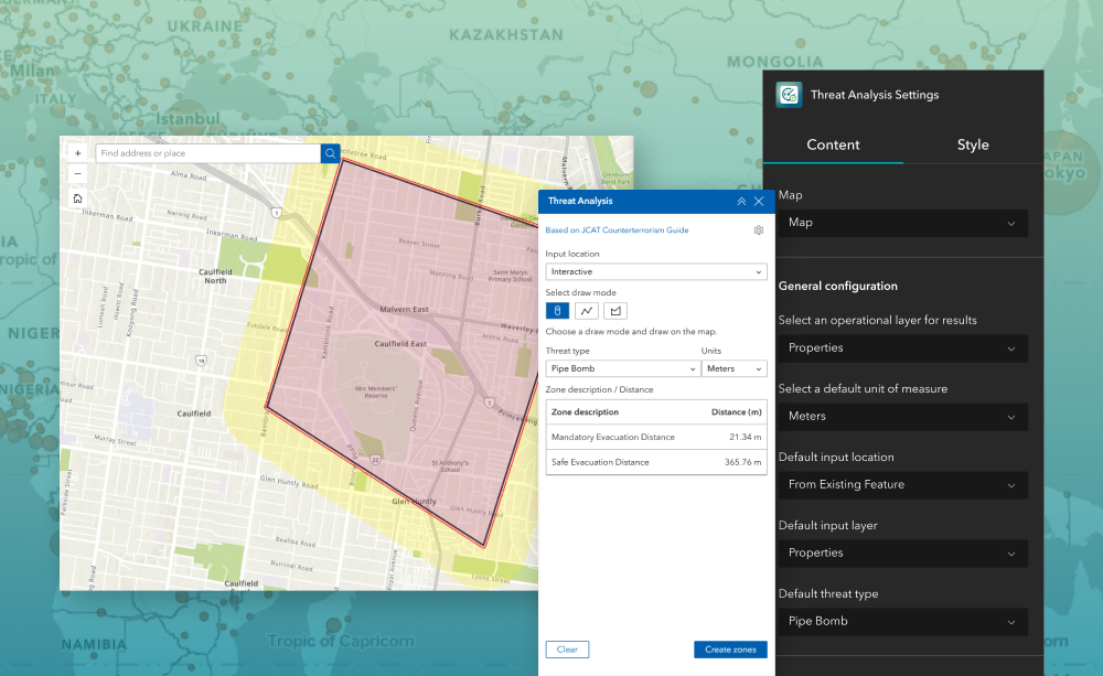
Plan safe perimeters and evacuation zones in seconds—directly in your web app.
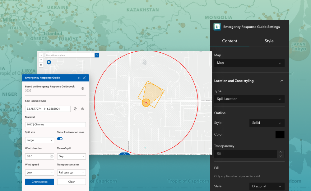
Quickly assess hazardous material spills by generating isolation and protective action zones based on spill type, location, and conditions, following the Emergency Response Guidebook.