
Grid Overlay

img

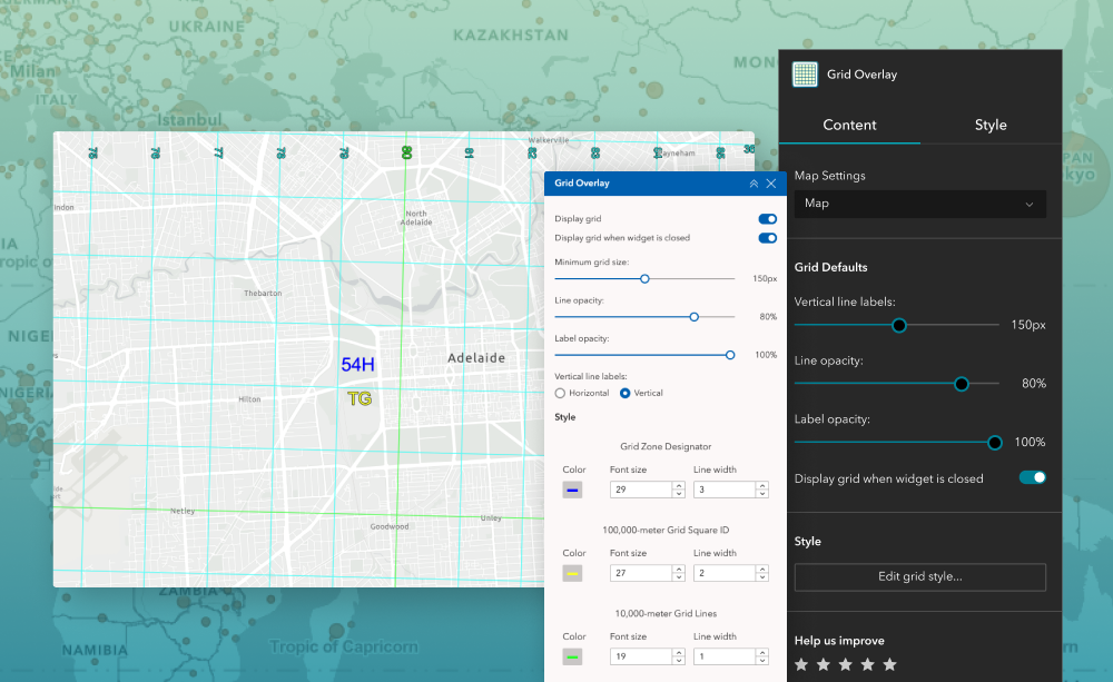
The Grid Overlay widget enables dynamic display of Military Grid Reference System (MGRS) grids within ArcGIS Experience Builder applications. The grid is rendered client‑side and automatically adapts to map scale, providing a clear and consistent spatial reference without impacting application performance.

This widget is ideal for users who require accurate coordinate referencing, situational awareness, and a standardized grid system across defence, emergency response, utilities, and field operations.


What it helps you do

  • Establish a shared, accurate spatial reference across web maps
  • Improve situational awareness and coordination using standardized grid systems
  • Maintain map clarity with scale‑appropriate grid detail as users zoom and pan

Key features

  • Displays Military Grid Reference System coordinates based on UTM and polar stereographic projections.
  • Client‑side display for fast, lightweight performance
  • Configurable grid spacing, colours, opacity, line width, and labels
  • Option to keep the grid visible when the widget is closed
  • Automatically adjusts grid index levels to maintain clarity and relevance at all map scales.

Example use cases

  • Emergency management and response coordination
  • Defence and security mapping applications
  • Field coordination and asset tracking
  • Government and public sector web mapping environments

Using ArcGIS Online?

If you don’t have access to ArcGIS® Experience Builder Developer Edition, try our Hosted Experience Builder environment. It is the fastest way to start using custom widgets like this one. No local setup or deployment required.


Learn more

Free
Live preview
Released On:
16 April 2026
Version:
1.0
Compatibility:
ArcGIS Enterprise v11.1+, ArcGIS Experience Builder v1.10+