
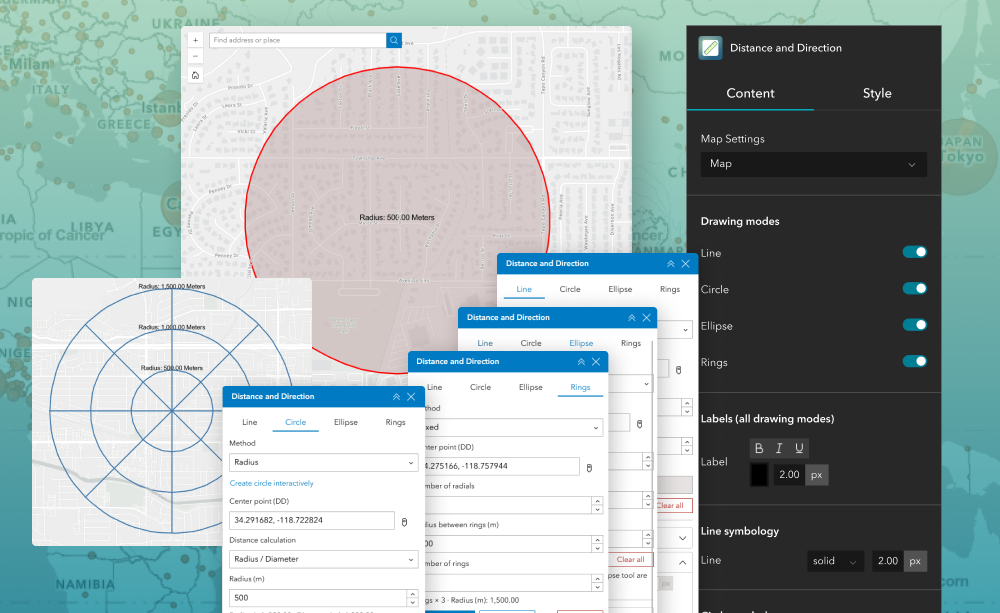
The Distance and Direction widget allows users to interactively visualize spatial relationships by drawing lines, circles, ellipses, and range rings on a map using distance, bearing, and coordinate inputs.
Key Features
Create lines using distance, angle, or coordinates
Draw lines, circles, ellipses, and range rings
Configure colors, labels, and symbology
Store outputs in operational layers for reuse
Support and customize multiple coordinate formats
Use Cases