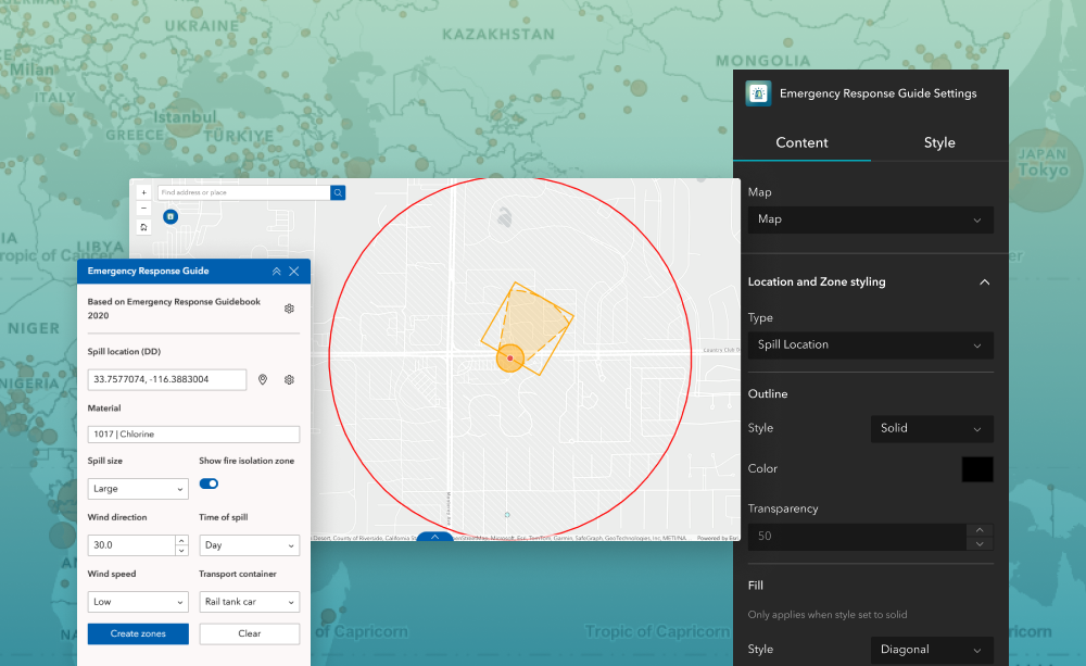
The Emergency Response Guide (ERG) widget helps users determine potential hazards and protective distances for hazardous material spills by referencing the Emergency Response Guidebook (ERG). Designed for ArcGIS® Experience Builder, this widget allows the creation of Initial Isolation Zones, Protective Action Zones, and other hazard‑specific buffers based on a user‑selected spill location and known conditions.
The widget mirrors the logic found in the orange and green ERG pages, including tables for isolation distances, toxic inhalation hazards, and BLEVE scenarios.
What it helps you do
- Identify hazard zones for a spill by selecting a location and material type, following guidance from the 2020 Emergency Response Guidebook.
- Visualize critical safety areas such as Initial Isolation Zones, Protective Action Zones, Downwind Zones, and Fire/BLEVE isolation zones.
- Standardize response workflows by applying consistent ERG‑based distances and symbology across your organization.
- Save outputs to an eligible polygon feature layer in the web map for documentation, reporting, or further analysis (must be owned by your organization).
Key features
- ERG‑based hazard modeling
Automatically generates hazard zones using ERG tables such as:
- Table I: Initial Isolation & Protective Distances
- Table III: Toxic Inhalation Hazard (TIH) large spill distances
- BLEVE hazard zones
- Configurable symbology
Customize color, transparency, and line style for each hazard graphic type:
- Spill Location
- Initial Isolation Zone
- Protective Action Zone
- Downwind Zone
- Fire Isolation Zone
- BLEVE Isolation Zone
- App start behavior
Optionally set the widget to open automatically when the app starts.
- Custom widget icon
Replace the default icon with your own uploaded image.
- Results layer support
Save generated hazard zones to a selected editable polygon layer from your organization’s content (third‑party layers won’t appear).
Example use cases
- Hazardous materials spill response
Quickly identify isolation and protective distances for chemical spills on highways, rail, industrial sites, or urban areas.
- Emergency planning & tabletop exercises
Pre‑simulate incidents using ERG distances to practice evacuation planning and response coordination.
- Public safety situational awareness dashboards
Integrate ERG outputs into common operating picture dashboards for real‑time field or command‑center decision making.
- Chemical plant & industrial facility safety
Assess worst‑case spill scenarios for internal emergency preparedness and safety compliance.
Using ArcGIS Online?
If you don’t have access to ArcGIS® Experience Builder Developer Edition, try our Hosted Experience Builder environment. It is the fastest way to start using custom widgets like this one. No local setup or deployment required.
Learn more