
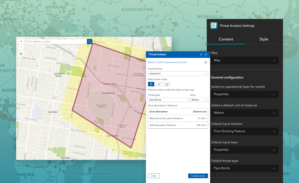
The Threat Analysis widget helps public safety teams and event planners quickly determine mandatory and safe evacuation distances for potential incidents (for example, chemical releases or LPG explosions). Designed for ArcGIS® Experience Builder, this widget supports configuration of default threat types, units, and inputs so your users can create standardized, repeatable zones—and optionally save results to an editable layer.
What it helps you do
Key features
Example use cases
Using ArcGIS Online?
If you don’t have access to ArcGIS® Experience Builder Developer Edition, try our Managed Experience Builder for ArcGIS environment. It is the fastest way to start using custom widgets like this one. No local setup or deployment required.